|
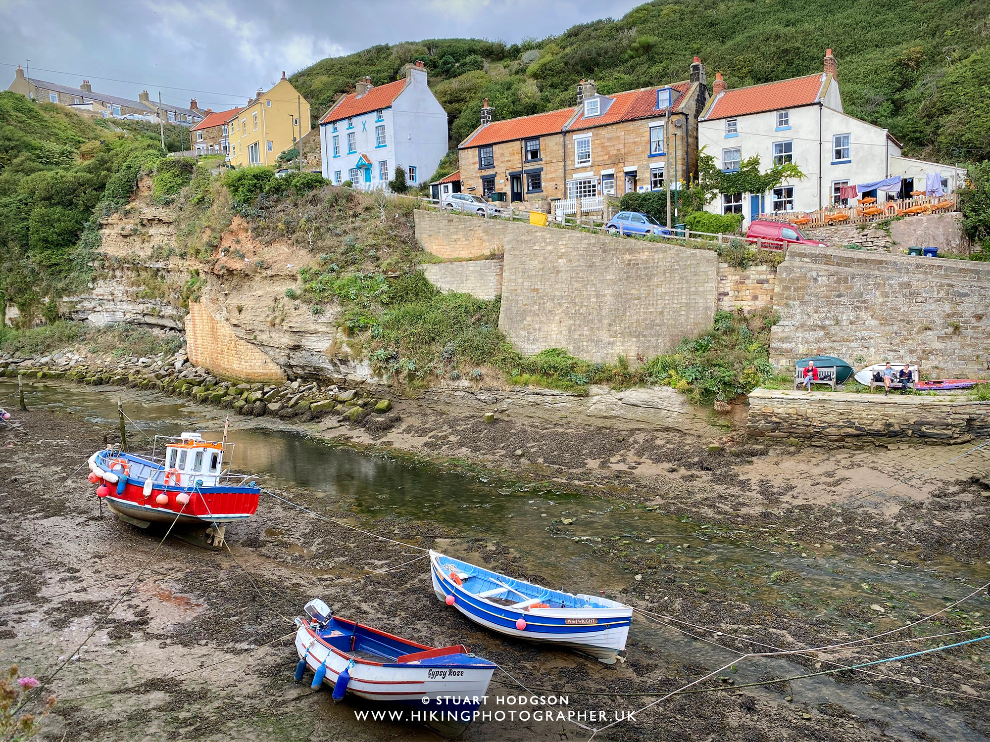
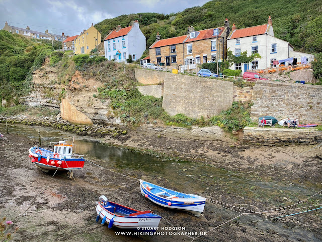
| This pic of Staithes is one of my best views in Northern England and you'll see it for yourself at the start of this walk |
A circular walk from Staithes, starting and finishing on the Cleveland Way
Staithes is a unique old fishing village on the North-Yorkshire coast which retains a lot of it's character from bygone years and is one of my favourite coastal locations. Many visitors to the area head straight for Whitby, but not me as I think Whitby is too crowded. Often I'll just visit the beach with the kids and we'll amble around the old streets, but if you have plenty of time and want to do a long walk, then this is a good one to do, it's a circular walk of about 6.5 miles, taking in the coast and inland woodland.
Staithes Circular Walk details:
Staithes Walk Distance: 6.5 miles
Staithes Walk Time: 3 hours
Staithes Walk Difficulty: Medium
Staithes Walk Map:
 |
| This walk starts and finishes in Staithes, from the Car Park just before you head down the steep road into Staithes (where the green flag is). Parking is £4 for all day. From the Car Park the route takes you down into Staithes - over the bridge over the beck and up to Cowbar, then towards the Boulby potash Mine, through woodland to Roxby and back to Staithes via Borrowby Dale. |
Photos of what to expect on this excellent walk from Staithes:
 |
You head out of Staithes via Cowbar Bank which you can see here - it will certainly get you warmed up!
 | At the top of Cowbar Bank you'll get a stunning view of the Staithes cottages in North-Yorkshire overlooking the quaint cottage rooftops.
|
|
 |
| The beginning of the walk covers a section of the Cleveland Way route along the coast, heading north towards the cliffs of Bias Scar. |
 |
| Looking towards Bias Scar and the higher Boultby Cliffs from Cowbar |
 |
| As we walked along the cliff edge on the Cleveland Way we head towards Boulby Potash Mine and follow this back lane to the main A174 road. It's then a case of heading left along the A174 for 20m or so - then crossing the road to head towards Roxby woods. |
 |
| The start of Roxby woods - the ford looks a little deep so it's over the bridge then right. |
 |
| Heading through Roxby woods. There was infact a sign at the start of the path into Roxby woods informing us of storm damage in the woods and especially to the foot bridge - and advising of a different route. We decided to crack on and figure out how to cross the beck when we got to the damaged bridge. |
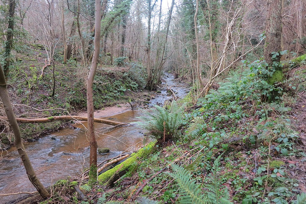 |
| Although it's winter and there are not leaves on the trees - the woods are still a nice place to walk through away from all the hustle and bustle. |
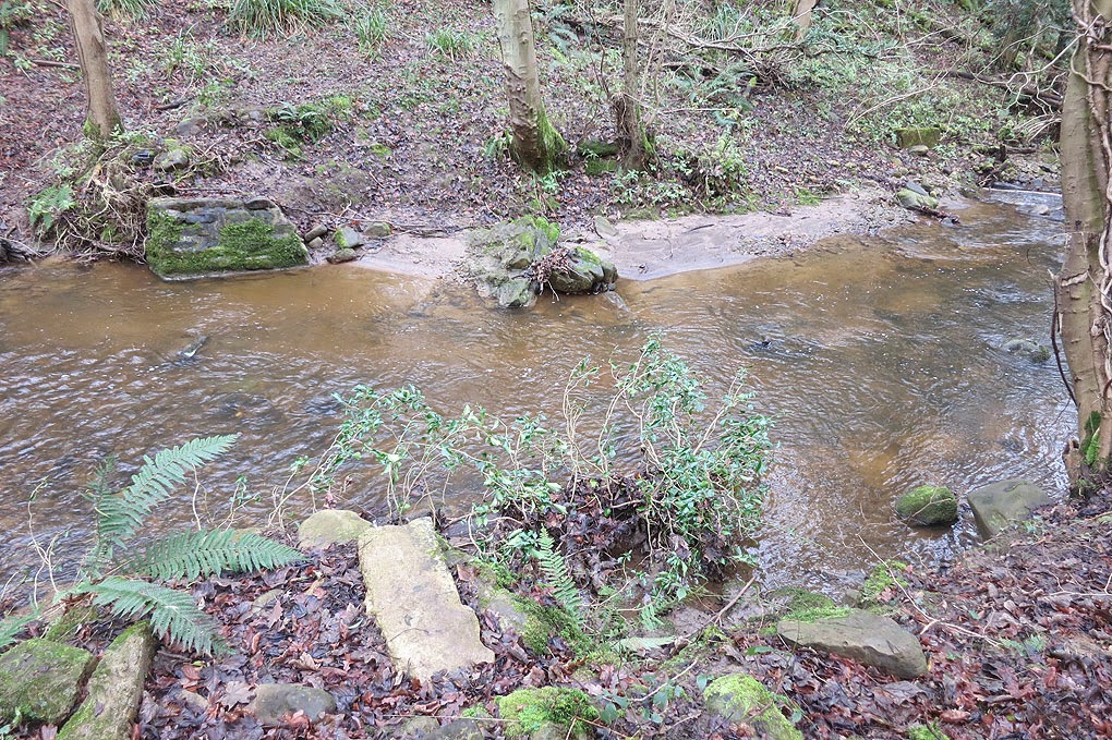 |
| As the path leads us to the damaged bridge - we see it is quite damaged - in that there is no bridge! haha - we were warned! We like a challege though so we take a look around the river for a place to cross. [Note: This blog post is from late 2015 and the bridge is due to be repaired] |
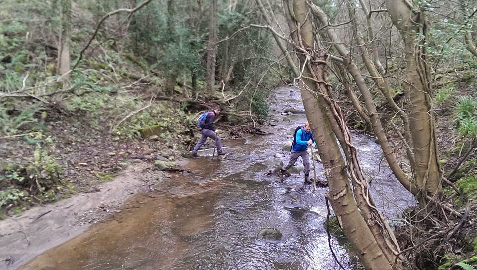 |
| Just left of the bridge crossing we see some rocks in the beck - so found sticks in hand - we scramble across and its not to hard to cross really - waterproof boots are handy on these occasions though haha. |
 |
| After crossing the beck it's up and out of the woods and towards Roxby church in the distance. |
 |
| It doesn't take that long to get to Roxby church. |
 |
| The Roxby the path takes us over some Borrowby Grange farm fields where we get a good view down to Staithes and the full walking route. |
 |
| A gentle stroll through Borrowby Dale - the gong here is easy - but in some parts it was quite boggy. |
 |
| We eventually emerge from the woods and take the path back towards Staithes. |
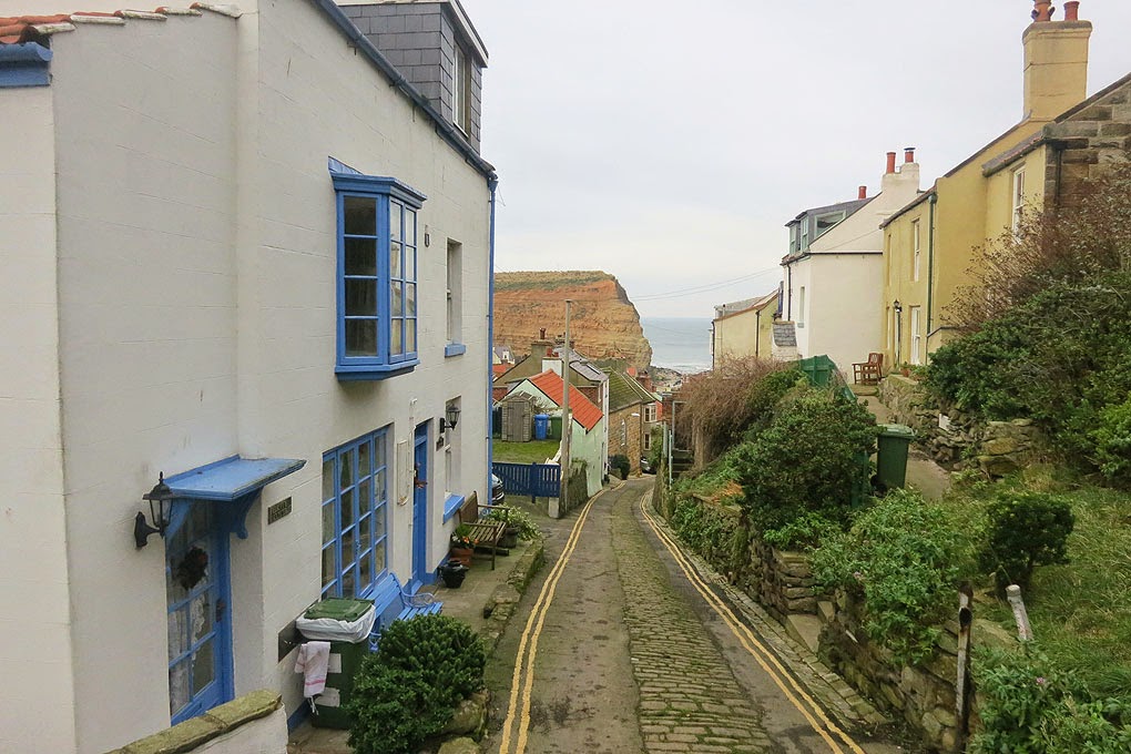 |
| The narrow streets and quirky individual houses give Staithes a lot of charm. |
 |
| We decide to head out onto the pier to get a different view of Staithes before we head to find a pub! |
 |
| We decide to head for the Cod & Lobster for a drink & some well-earned food as it's the first pub we see and is in a great little spot right by the sea. |
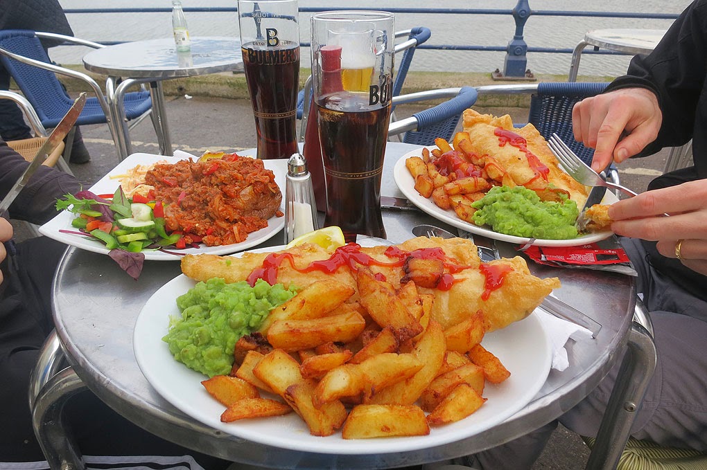 |
| I don't normally post a picture of food - but the fish & chips from the Cod & Lobster was superb - as good as it gets - so I highly recommend this pub for food if you are down this way! |
All in all the walk was around 6.5miles and can be done in a couple of hours with time for a few stops. I can imagine the woodland section being even better in spring/summer/autumn - so will no doubt head back at some point - good excuse to go back to the Cod & Lobster too :-)
Hope you've found that write up useful and makes you want to check it out, Stuart.
Happy Hiking!
Post by Stuart Hodgson
'The Hiking Photographer'
Subscribe to my monthly email newsletter to stay up to date with all my outdoor adventures, including my latest photos & walking blog posts, as well as a whole host of tips & interesting stuff for outdoor enthusiasts, just click the link below to subscribe.
FOLLOW ME
Not all my adventures & photos end up on this blog -
Give me a follow to see what else I've been up to!