 |
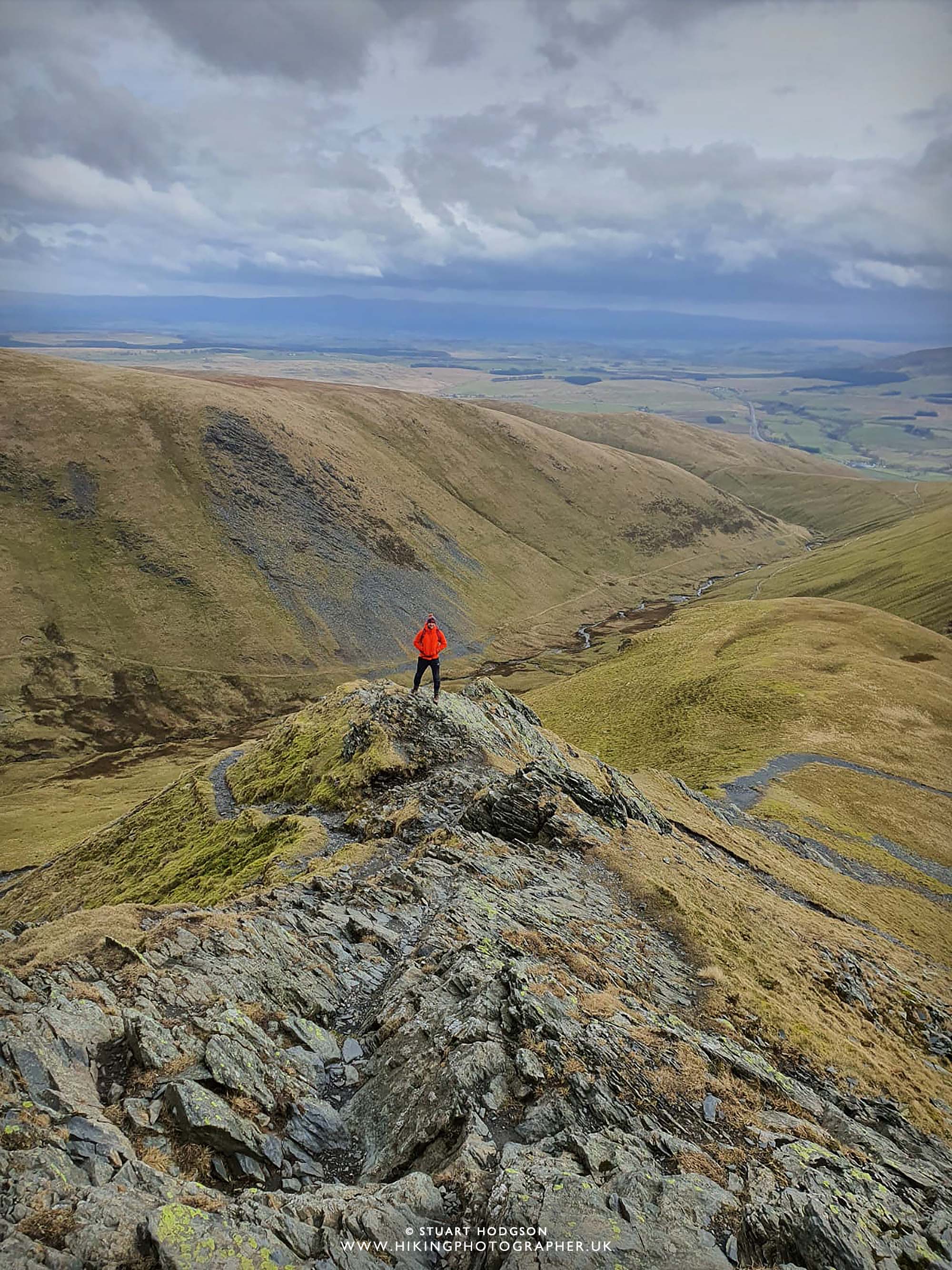
| Walking along the formidable Sharp Edge en-route to the summit of Blencathra - my favourite Lake District ridge |
Blencathra walk via Sharp Edge and Halls Fell Ridge
Sharp Edge has got to be one of the Lake Districts finest and most exhilarating ridge to walk along. If you've got a head for heights - then I highly recommend it as a way to summit the iconic summit of Blencathra, near Keswick. The beauty of this walk - is that it entails 2 ridges - not only Sharp Edge on the ascent - but it comes back down via Halls Fell Ridge, and excellent ridge in itself. If your looking for a day of fun, excitement and challenge and you've got a head for heights - then this Blencathra walk in the Lake District has it all
Blencathara Walk overview:
Blencathra walk distance: 4.8 mile
Blencathra walk time: 3 hours
Blencathra walk difficulty: Difficult
You'll need a head for heights on this walk as it's quite steep and sheer in places, and you'll also need to use your hands. You won't need any specialist equipment other than sturdy boots. As long as the weather is fine (avoiding strong winds, rain, ice & snow) it's quite safe. It looks worse than it is :-)
Map route - Blencathra walk via Sharp Edge and Halls Fell Ridge:
 |
| I recommend doing this walk in an anti-clockwise route, parking near Scales and head up to Scales Tarn first then onto Sharp Edge and the summit of Blencathra. You descend via Halls Fell ridge. View the full interactive map route below. |
If you don't have a Phone Map App - I really recommend the one by Ordnance Survey. You can download route maps to your phone such as this one and the app will show you exactly where you are on the route even when you have no signal - so no more taking a wrong turn :-)
Photos of what to expect on this Blencathra walk via Sharp Edge and Halls Fell Ridge
 |
| On the ascent up towards Scales Tarn you soon get a glimpse of Sharp Edge and the highlight of the walk |
 |
| Today there is a bit of snow lingering around, but fortunately not on Sharp Edge itself, which would make the walk very tricky indeed |
 |
| We soon approach Scales Tarn and it's the perfect place for a pit stop and to get rested and prepared to tackle Sharp Edge which overlooks the tarn |
 |
| A lone hiker on a walk along Sharp Edge |
 |
| The walk up to the beginning of Sharp Edge is clear and well-marked |
 |
| Looking back to the first section of Sharp Edge - as you can see the drops either side here aren't that sheer |
 |
| The views from Sharp Edge are incredible - with fine views of Scales Tarn below and the Pennines in the far distance |
 |
| Looking back to some walkers who are just behind us on our ascent up Sharp Edge |
 |
| The final push for the summit is where Sharp Edge gets a bit steeper, the path more unclear and the jagged rock face of Sharp Edge takes over. It's just a case of picking out your own route which is fairly straight-forward in good visibility. On occasions on this last section the drops become a bit more severe, but as long as you keep you wits about you nothing is too tricky though I don't think. |
 |
| We reach Atkinson Pike first where we encounter a bit of snow. From here there's maybe only another 20m of ascent left and the going is easy for a 5 min walk to the summit of Blencathra. |
 |
| We've made it! The summit of Blencathra - looking over towards Keswick and Derwent Water. From here there are multiple routes down, with Scales Fell been the easiest way back to the start. On this walk though we are heading back down Halls Fell Ridge - for more exhilarating walking. |
 |
| Making our way down Halls Fell Ridge - which is steep at times and can require you to use your hands or even bum! The path is quite clear though all the way down. |
 |
| We have got all the way to the bottom of Halls Fell Ridge now and here we look back up at the summit of Blencathra. What a walk - and a perfect one if you like exhilarating ridge walks. |
If you don't have a Phone Map App - I really recommend the one by Ordnance Survey. You can download route maps to your phone such as this one and the app will show you exactly where you are on the route even when you have no signal - so no more taking a wrong turn :-)
Happy Hiking!
Post by Stuart Hodgson
'The Hiking Photographer'
Subscribe to my monthly email newsletter to stay up to date with all my outdoor adventures, including my latest photos & walking blog posts, as well as a whole host of tips & interesting stuff for outdoor enthusiasts, just click the link below to subscribe.
FOLLOW ME
Not all my adventures & photos end up on this blog -
Give me a follow to see what else I've been up to!


No comments
Post a Comment
Thanks for taking an interest in my blog, all comments and questions are welcome! Best, Stuart