
 |
| Mount Snowdon (Yr Wyddfa in Welsh) is one of the UK's finest walks - and here's the 4 best walking routes to summit Wales highest mountain |
MOUNT SNOWDON WALK #1via the Pyg Track and Miners Path
Snowdon walk distance: 7.59 miles
Snowdon walk time: 4.5 hours
Snowdon walk difficulty: Moderate
This is perhaps the most popular walking route to Mount Snowdon and you will go up via the pig Track and come down via The Miners Track. The views are simply incredible on this route and you can see why many people flock to Mount Snowdon to take on this walk.
 |
| This popular Mount Snowdon route takes in both the Pyg Track & Miners path. As you can see on the map this Mount Snowdon walk starts from the car park at Pen-y-pass and go via either the Pyg Track or Miners Track. This Snowdon route below ascends via the Pyg Track, which will give you great views of Snowdon from an elevated level above Llyn Llydaw. It will then meet the Miners Track for the last bit of ascent to the summit of Mount Snowdon. On the descent you will follow the Miners Track all the way back. Click the button below to view the full interactive map on OS Maps. |
If you don't have a Phone Map App - I really recommend the one by Ordnance Survey. You can download route maps to your phone such as the ones on this page and the app will show you exactly where you are on the route even when you have no signal - so no more taking a wrong turn :-)
 |
|
| Incredible views are to be had on The Pyg track on this Mount Snowdon walk. I really do recommend going up via the Pyg Track and descending via the Miners Track |
MOUNT SNOWDON WALK #2The Snowdon Horseshoe via Crib Goch
Snowdon walk distance: 7.1 milesSnowdon walk time: 5 hoursSnowdon walk difficulty: Difficult
This is the most exhilarating and challenging way to walk to the summit of Mount Snowdon and is my personal favourite, as it takes in the mighty ridge of Crib Goch on the way up (one of my favourite ridges in the whole of the UK). If you have a head for heights, like a bit of a scramble and the weather is playing ball - then Crib Goch is the way to go on a walk to Mount Snowdon. On the descent Y Lliwedd offers some equally stunning views.
 |
| The Mount Snowdon Horseshoe walk starts again from Pen-y-pass, avoids the Pyg/Miners path and heads initially to Carreg Gwalch and then up onto Crib Goch. Crib Goch is an excellent ridge, which is steeper on the Northern face than the south. There are 3 rocky pinnacles to navigate where hands will be required. the first of the 2 pinnacles you can go around then using your hands, the 3rd Pinnacle you will have to go up and over and is the trickiest scramble. Once past Crib Goch it's onto Garnedd Ugain and the onto the summit of Snowdon. From there you do have the option to return via the more popular and shorter Pyg or Miners track, but the true Horseshoe loop takes you south from the Snowdon summit to Y Lliwedd for more stunning views. You'll then descend and head onto the Miners Track for the last section. Click the button below to view the full interactive map on OS Maps. |
 |
What a view! A walker on the Crib Goch ridge. You can just make out the summit of Mount Snowdon where the clouds have cleared a little to the right of the walker, and further to the right is the summit of Garnedd Ugain. The Crib Goch section of the walk is one of the best ridge routes in the UK. It may look precarious - but it's much steeper on the north face (right of this photo) with a more gentler south face, so if you feel the exposure - just drop down off the ridge top and walk a little bit down on the south ridge. There are though 3 pinnacles/rocky out-crops to navigate where hands will be required. |
MOUNT SNOWDON WALK #3via Llanberis path
Snowdon walk distance: 9 milesSnowdon walk time: 5.5 hoursSnowdon walk difficulty: Moderate
The Lllanberis path is the most pedestrian and clear path, the most leisurely/gentle to walk and likely to be the busiest, becoming a bit of a walking motorway in summer months. It broadly follows the path of the mountain train up and down.
 |
| The Llanberis path is the most straightforward route with clearly marked paths all the way to the summit of Snowdon. It starts, as you would guess from Llanberis and heads straight to the Snowdon summit with the train track never far away. Once at the top of Snowdon - simply retrace your steps. Click the button below to see the full interactive route on OS maps. |
 |
| The Llanberis path largely follows the route of the Snowdon mountain train and is the easiest, albeit the longest walk to the Snowdon summit |
MOUNT SNOWDON WALK #4via South Ridge & Watkin Path
Snowdon walk distance: 8 milesSnowdon walk time: 5 hoursSnowdon walk difficulty: Moderate
 |
| Starting at the car park in Nantgwynant, you'll head up the Cambrian Way towards the satellite peak of Yr Arran and then onto the thrilling, non-technical south-ridge to the summit of Snowdon. This Snowdon walk feels like a big, big mountain when done from this direction. The descent takes in the Watkin path - where you'll get stunning views all the way back, with waterfalls and forests thrown in for good measure. |
 |
| By tackling Mount Snowdon via the more unfamiliar South Ridge and Watkin path, you'll see some amazing views that not many who join you on the top of Snowdon will have seen |
MOUNT SNOWDON WALK #5via Rhyd-Ddu path & Snowdon Ranger Path
Snowdon walk distance: 8.75 milesSnowdon walk time: 5 hoursSnowdon walk difficulty: Hard

And there you have it - 5 of the best walking routes to the summit of Snowdon, each with their own charm and views. I hope this blog post helps in planning your own Mount Snowdon adventure!
If you don't have a Phone Map App - I really recommend the one by Ordnance Survey. You can download route maps to your phone such as the ones on this page and the app will show you exactly where you are on the route even when you have no signal - so no more taking a wrong turn and getting lost - which is easy to do on a Mont Snowdon walk!
|
Mount Snowdon FAQ
For those completely new to Mount Snowdon - here are the frequently asked questions:
Where is Mount Snowdon located?
Mount Snowdon is located in Snowdonia National Park in North Wales, United Kingdom.
How tall is Mount Snowdon?
Mount Snowdon stands at 1,085 meters (3,560 feet) tall.
What is the best time to climb Mount Snowdon?
The best time to climb Mount Snowdon is during the summer months (June-August) when the weather is usually more predictable and the days are longer.
What are the different routes up Mount Snowdon?
There are several routes up Mount Snowdon, including the Llanberis Path, Pyg Track, Miners' Track, Crib Goch, Snowdon Ranger Path, and Rhyd Ddu Path.
How long does it take to climb Mount Snowdon?
The time it takes to climb Mount Snowdon depends on the route taken and the fitness level of the climber. The Llanberis Path, which is the easiest and most popular route, usually takes about 6 hours round trip.
Do I need a permit to climb Mount Snowdon?
No, you do not need a permit to climb Mount Snowdon.
Is there an entrance fee for Snowdonia National Park?
No, there is no entrance fee for Snowdonia National Park.
What should I wear to climb Mount Snowdon?
You should wear sturdy hiking boots or shoes, comfortable and weather-appropriate clothing, a waterproof jacket, and bring plenty of food and water.
Are there any facilities on Mount Snowdon?
There are a few facilities on the Mount Snowdon summit, including a café at the summit and several toilets along the routes.
Happy Hiking!
Post by Stuart Hodgson 'The Hiking Photographer'
Subscribe to my monthly email newsletter to stay up to date with all my outdoor adventures, including my latest photos & walking blog posts, as well as a whole host of tips & interesting stuff for outdoor enthusiasts, just click the link below to subscribe.

FOLLOW ME
Not all my adventures & photos end up on this blog -
Give me a follow to see what else I've been up to!


 |
| Help support this blog and buy some unique greeting cards or landscape prints by Stuart Hodgson (The Hiking Photographer) - visit www.hikingphotographer.bigcartel.com |
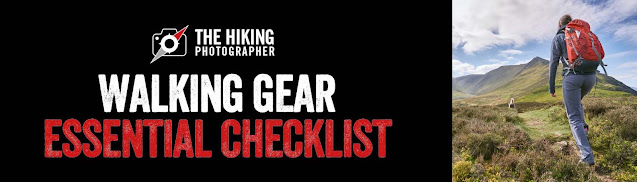 |
| A useful blog post on recommended essential walking gear |

No comments
Post a Comment
Thanks for taking an interest in my blog, all comments and questions are welcome! Best, Stuart