 |
| The panoramic views from Latrigg of Keswick are unequalled in the area - it's a must-do short walk in the Keswick area |
Latrigg Fell walk - a must do short walk in the Keswick area
Latrigg Fell is one of the lower Lake District Fells standing at 368m tall but it has excellent panoramic views of Keswick, Derwent Water, Bassenthwaite and the surrounding fells such as Skiddaw to the north, the likes of Catbells, and Robinson to the west and even over to the Helvellyn range to the east. On a good clear day you can even see the might Scafell Pike & Great Gable at the head of Borrowdale at the opposite end of Derwent Water. For a modest fell in height it certainly packs a punch for the views. Infact for first time visitors to the Keswick area I'd say it's a must visit fell.
A QUICK & SHORT LATRIGG WALK
You can walk to Latrigg from Keswick, and many do. However if you are pushed for time (like we where), or have kids (or mobility issues) and want to get some stunning Lake District views on a shorter walk, you can park quite close to Latrigg in the free car park, which is at 280m elevation - so you've only got 80m of ascent to the summit of Latrigg! There's not many places where you can get such spectacular views for so little effort.
Latrigg Fell walk map
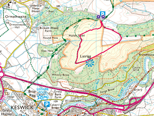 |
| This Latrigg Walk from the Latrigg Car park is only 1.5 miles, with 80m of ascent and can be done in 50mins or so. I suggest doing it anti-clockwise, and the paths are pretty easy to follow on the ascent) - you may need to refer back to your map a few times on the little descent. You can of course extend the Latrigg walk and do it from Keswick and follow the Cumbria Way path to the car park, or indeed head up via the forested 'Whinny Brow' area to the south of the summit. View full map route by clicking the button below. |
If you don't have a Phone Map App - I really recommend the one by Ordnance Survey. You can download route maps to your phone such as this one and the app will show you exactly where you are on the route even when you have no signal - so no more taking a wrong turn :-)
Where is the car park for Latrigg Fell?
The closest place to park for an easy and accessible Latrigg walk is at the small car park on Gale Road above Applethwaite. The post code area is CA12 4PQ, however if you head for The Spa at Underscar and continue along that road for a couple of mins you will arrive at the car park, which is free and has space for around 15 cars. This car park is also popular for walkers who tackle Skidded so may be busy on weekends.
 |
| The Latrigg Car Park on Gale Road has space for about 15 cars or so and is free of charge - which makes a nice change! The car park elevation is 280m - so you only have an extra 80m or so to the summit of Latrigg - about as easy a walk as you can get in the Lakes! |
 |
| The Latrigg Car park can be found along Gale Road - if you search for 'Latrigg Car park' on google it should throw up this location. Otherwise head for the Spa at Underscar and keep driving along Gale Road for a few more mins. |
Photos of what to expect on this quick Latrigg walk near Keswick
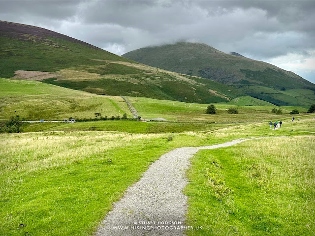 |
| The path to the Latrigg summit is well marked and easy to follow. It's also great for those with mobility issues. |
 |
| The views of the surrounding Lake District fells soon open up |
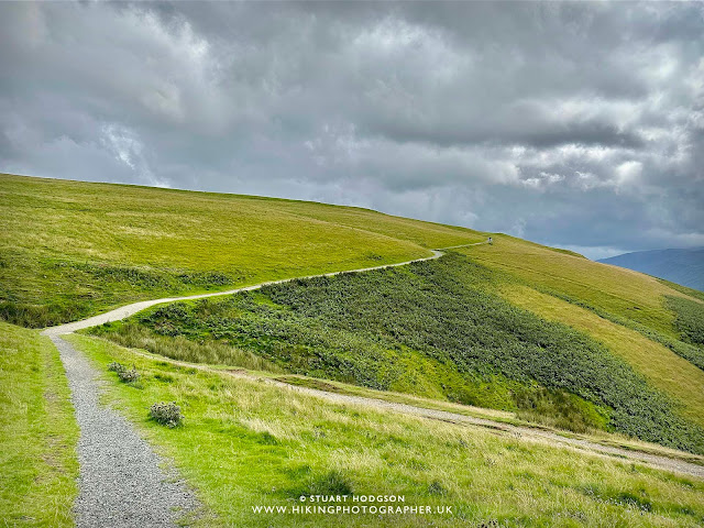 |
| There is not a great deal of ascent on this Latrigg walk, with the car park on this route being high up - you only have about 80m or so of ascent to do. Some will say that's cheating haha - but if you are pushed for time or have kids or mobility issues then it's it's a fantastic route. |
 |
| You get views all the way to Bassenthwaite lake |
 |
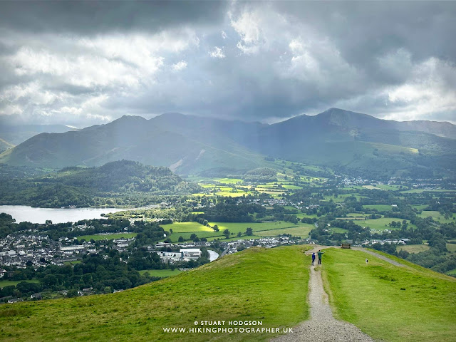
| The views of Keswick and beyond from Latrigg really are stunning |
 |
| This well placed bench is perfect to soak up the panoramic Lake District views |
 |
| Looking back again towards Bassenthwaite Lake |
 |
| We head onwards to the true summit of Latrigg which is only around 10m or so higher than where the bench is, however the bench spot has the best views to get those photos! |
 |
| This part of the walk follows as less defined path across the fields in the direction of Blencathara - but we won't be on this path for long at all |
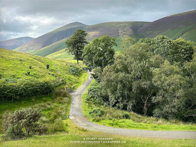 |
| As soon as you see the more defined dirt track - head down onto that and just follow it back to the car park for what is a relatively quick and short Lake District walk near Keswick. |
Happy Hiking!
Post by Stuart Hodgson
'The Hiking Photographer'
Subscribe to my monthly email newsletter to stay up to date with all my outdoor adventures, including my latest photos & walking blog posts, as well as a whole host of tips & interesting stuff for outdoor enthusiasts, just click the link below to subscribe.
FOLLOW ME
Not all my adventures & photos end up on this blog -
Give me a follow to see what else I've been up to!


No comments
Post a Comment
Thanks for taking an interest in my blog, all comments and questions are welcome! Best, Stuart