
 |
| This 25 mile hike along my favourite section of the Cleveland Way is a great walking challenge. Read on to learn more... |
A superb walking challenge along the Cleveland Way in North Yorkshire
Full write up to come...
WALK DISTANCE: 25.32 miles
TOTAL ASCENT: 4567ft
WALK TIME: 12.5 hours
WALK DIFFICULTY: Hard & long!
Map route from Osmotherely to Roseberry Topping:
 |
| The full route along the Cleveland Way from Osmotherly to Roseberry Topping. Full interactive map route below: |
If you don't have a Phone Map App - I really recommend the one by Ordnance Survey. You can download route maps to your phone such as this one and the app will show you exactly where you are on the route even when you have no signal - so no more taking a wrong turn :-)
 |
Happy Hiking!
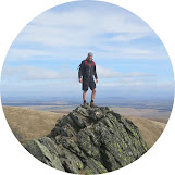
Post by Stuart Hodgson 'The Hiking Photographer'
I share my adventures as I love the outdoors and it's spectacular natural landscapes and want to help others get outdoors too. Being outside can also bring many physical and mental health benefits to us and I want others to reap these benefits too. I hope you enjoy the blog and it inspires you to plan a trip!
You can subscribe to my quarterly email newsletter, featuring my recent outdoor adventures, latest photos & blog posts, just click the link below!

FOLLOW ME
Not all my adventures & photos end up on this blog -
Give me a follow on the social channels below to see what else I've been up to!


No comments
Post a Comment
Thanks for taking an interest in my blog, all comments and questions are welcome! Best, Stuart