 |
| Cow Close Gill Waterfall or Middle Falls - One of my favourite Yorkshire Waterfalls. Read on to learn where it is... |
One of Yorkshires best waterfalls - Cow Close Gill Waterfall or 'Middle Falls'
This stunning waterfall actually has no name - quite surprising about considering how picturesque it is. On google maps it's referred to as Middle Falls, and elsewhere it's referred too as Cow Close Gill Falls as its on Cow Close Gill. Not many people have heard of it compared to the more well-known waterfalls in Yorkshire, and you won't see many photos of it as it's a little off the beaten track in Upper Warfdale, however its quite near a roadside parking spot, and can actually be seen on the drive, but few actually park up and walk right up to the waterfall. If you do like your waterfalls like me, then I highly recommend paying a visit to this place if you’re in this quiet part Yorkshire.
Location of Cow Close Gill Waterfall or 'Middle Falls'
Below is the google map location for this stunning waterfall - which on google maps is referred to as 'Middle Falls'
 |
| My favourite view is from the bottom of the falls but you can easily venture up it to view all tiers and even stand right on the top |
Map route of the shortest walk to Cow Close Gill Waterfall or 'Middle Falls'

For a very quick walk to check out the waterfalls - there is road side parking for a couple of cars near Cray High Bridge, just north or Buckden - and then there is a short walk of 0.26 miles to the falls in the direction shown above. See interactive OS Map route below:
Idea for a longer walk in Upper Wharfdale - taking in the waterfalls
 |
| If you want more of a leg stretcher - then this 5.6 mile walk from Buckden is a really good walk. You'll head north out of Buckden on the 'Buckden Rake' path - where you'll take a little detour to get up close to Cow Close Gill waterfalls. From there you'll walk a little bit on the road to take in Cray Gill Waterfalls and then head west on a footpath giving excellent views of Upper Wharfdale, then down to Hubberholme and finally back to Buckden along the Dales Way |
If you don't have a Phone Map App - I really recommend the one by Ordnance Survey. You can download route maps to your phone such as this one and the app will show you exactly where you are on the route even when you have no signal - so no more taking a wrong turn :-)
Happy Exploring!
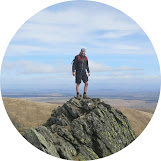
Post by Stuart Hodgson
'The Hiking Photographer'
I share my adventures as I love the outdoors and it's spectacular natural landscapes and want to help others get outdoors too. Being outside can also bring many physical and mental health benefits to us and I want others to reap these benefits too. I hope you enjoy the blog and it inspires you to plan a trip!
You can subscribe to my quarterly email newsletter, featuring my recent outdoor adventures, latest photos & blog posts, just click the link below!
FOLLOW ME
Not all my adventures & photos end up on this blog -
Give me a follow on the social channels below to see what else I've been up to!


No comments
Post a Comment
Thanks for taking an interest in my blog, all comments and questions are welcome! Best, Stuart